
Search Burbank Streets by Parcel
A careful street directory search begins with one complete address. Run it through the Los Angeles County Assessor Portal and save the AIN, situs address, legal description, and any public mailing fields. Put the same address into the Burbank map, then click the target parcel and the lots that touch it. The city property portal adds permits and inspection events. Only after the parcel has a current owner clue should the recorder's name-and-year index enter the workflow.
That order matters because Los Angeles County deeds are not indexed by street address online. A street name can locate a parcel, but the deed trail needs a grantor or grantee and an approximate recording year. A directory or voter clue can suggest occupancy, yet an owner, a mailing address, and an occupant are different facts. Treat each source as one link in the chain.
- Enter the full address in the Assessor or Burbank Property Information Portal and record the AIN or APN.
- Open the Burbank citywide map, zoom until lot lines are distinct, and click the target parcel and nearby parcels.
- Use permits to note construction, remodel, inspection, and certificate milestones with their named project parties.
- Take the current owner clue and likely acquisition year to the RR/CC grantor-grantee index in Norwalk.
- Use reverse directories and newspapers for older listed occupants, then cross-check any person in a separate record.
Burbank Street Records Begin With Three Addresses
A Burbank street directory search can fail when three address ideas are treated as one. The situs address is the parcel's physical location. The assessor mailing address is where tax notices go. The legal description identifies the surveyed land by subdivision, lot, block, or another description. An AIN is the cross-system key that helps connect parcel facts to a deed request and a map record.
The mailing field can support a locate clue, but it is not proof that the person receiving tax notices lives at the situs. A legal description usually survives a street spelling change better than a typed street string. Public Works at 150 N. Third Street holds address maps, assessor parcel maps, tract and parcel maps, cadastral and easement sheets, sewer cadastral material, and street plans. Call (818) 238-3950 or email pwonlinecounter@burbankca.gov when an old address needs a map bridge.
- Parcel
- A mapped piece of land identified by an AIN, APN, geometry, and legal description.
- Situs address
- The physical address assigned to the land, distinct from a tax-mail address.
- Plat
- A recorded or public map that lays out lots, blocks, streets, and related land divisions.
- Criss-cross directory
- A reverse directory arranged by street and house number, often listing a subscriber or householder.
Burbank Street Search Fields
The Los Angeles County Assessor Portal exposes three useful modes. Basic Search uses a single “Search by AIN or Address” text or autocomplete field. Legal Search offers legal-description routes whose exact dynamic labels should be checked in the live interface. Map Search permits map navigation and parcel selection. A query is needed to obtain results, and the public portal does not expose a general owner-name search.
| Portal control | Type | Required | What it does |
|---|---|---|---|
| Basic Search | Text/autocomplete | Query required | Search by AIN or address |
| Legal Search | Legal-description route | Query required | Search by the parcel's legal path |
| Map Search | Interactive map | Selection required | Pan, zoom, and select a parcel |
| Assessor result | Record card | After a match | AIN, situs, legal, assessment, and public parcel facts |
Save the record-effective date and the exact address string. A typical result may include AIN or APN, situs, legal identifiers, parcel geometry, land year, zoning code, mailing address and ZIP fields, and assessed characteristics or values. Protected addresses and exemptions require care. The Assessor is a parcel custodian, not a household registrar.
The Burbank Property Information Portal is a useful second search: one field accepts Address, APN, or Permit Number. It can reveal permit chronology, but transactional functions may require registration and inspection scheduling uses a nine-digit permit beginning with “BS”.
For the map and property portal relationship, start at Burbank Planning and Zoning and open the authoritative parcel layer. The image below is the parcel-layer capture used for the street directory.
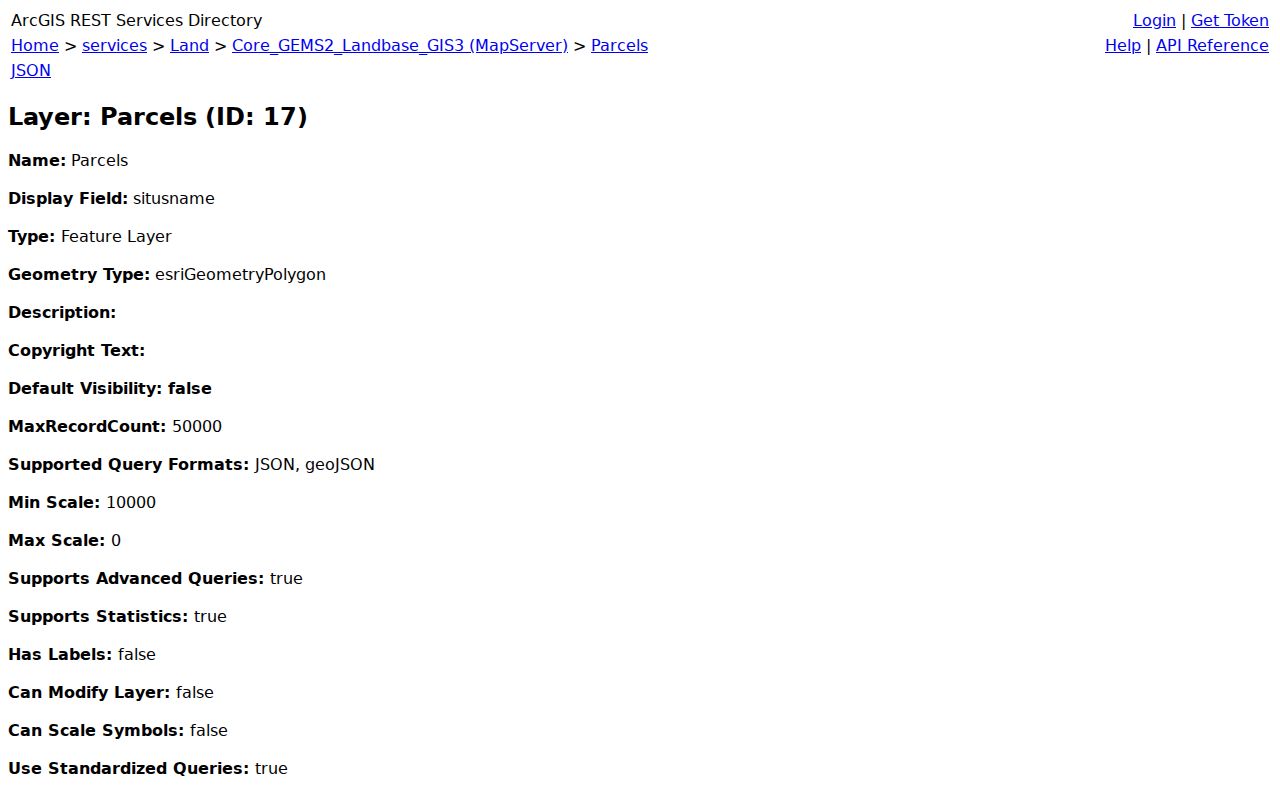
The city map is best used to locate and compare parcels. It should not be read as a current list of occupants.
Burbank Records Searchable by Street
Address-keyed sources form the working core of a Burbank street directory. The parcel map supplies geometry and AIN, the Assessor supplies tax and legal clues, and Building & Safety supplies project history. The recorder requires a name-and-year conversion. The voter status tool requires a person's own details, so it cannot be used as a public street browser. Historical reverse directories add named entries only for the years and areas they surveyed.
| Record set | Keeper | Street-level use | Access |
|---|---|---|---|
| Assessment parcel | LA County Assessor | AIN, situs, legal facts, tax-mail clue | Free address or AIN portal |
| GIS parcel map | City of Burbank | Lot shape, zoning, adjacent geometry | Free map and service |
| Building permits | Burbank Building & Safety | Work, inspection, and project parties | Portal or counter |
| Recorded deeds | LA County RR/CC | Owner transfers after name conversion | Norwalk index; copies ordered |
| Reverse directories | LAPL and library collections | Listed occupant by street and number | Digital or library access |
Use the AIN to keep the chain straight when a street has many parcels or a name repeats. A building permit can name an applicant or contractor without naming a resident. A reverse-directory entry can name a subscriber without listing every person at the address. The record set answers a narrow question; the source hierarchy prevents overclaiming.
Walk a Burbank Street Through GIS
The friendly map begins at the citywide mapping page. Search or locate the target address, zoom until parcel polygons and house-number labels can be read, and click the target. Record the AIN and situs, then click the lots sharing side or rear boundaries and the lots across the street. Pan and layer controls show context; they do not create an official neighbor list.
The underlying Burbank parcel layer exposes fields such as apn_string, ain, saddress, mailaddr, mailzip, mailzip4, zoningcode, landyr, and geometry. It supports pagination, statistics, distinct and distance queries with a 50,000-record maximum service setting. A service field can be useful for research, but protected or suppressed address data should never be republished.
Open each AIN in the Assessor Portal in a separate tab. For a whole named street, repeat the parcel step, not an imagined bulk owner search. If the goal shifts to the immediate block, the Burbank neighbors page focuses on adjacent parcels and community context rather than the full street chain.
Burbank Street Records From Deeds
Los Angeles County records real-estate instruments from 1851 to the present, but its alphabetical grantor-grantee and year indexes are reviewed in person at Norwalk. The index is not searchable by address. Start with the current assessed owner and approximate acquisition year, then search that person as grantee. The deed supplies the prior grantor, legal description, recording date, and instrument number. Search the prior seller as grantee in an earlier year and repeat.
- Save the parcel's AIN, legal description, and current assessed owner clue.
- Estimate the current acquisition year from parcel and recorded-document clues.
- At 12400 Imperial Highway, search the grantor or grantee index for the name and year.
- Retrieve the instrument and note every party, legal description, recording date, and document number.
- Search the prior grantor as grantee, including trust, business, spouse, and spelling variants.
The 1851-1957 index review is on the lower level; 1958-present is on the second floor. RR/CC answers procedure at (800) 201-8999, but it does not accept a phone index search. Known instruments can be ordered online, by mail, fax, or at the counter. The published online estimate is within 20 working days, with the copy or certification fee checked when ordered.
Read the county real-estate records request instructions before ordering. The image is a request-channel capture, not a claim that an address can be typed into the deed index.
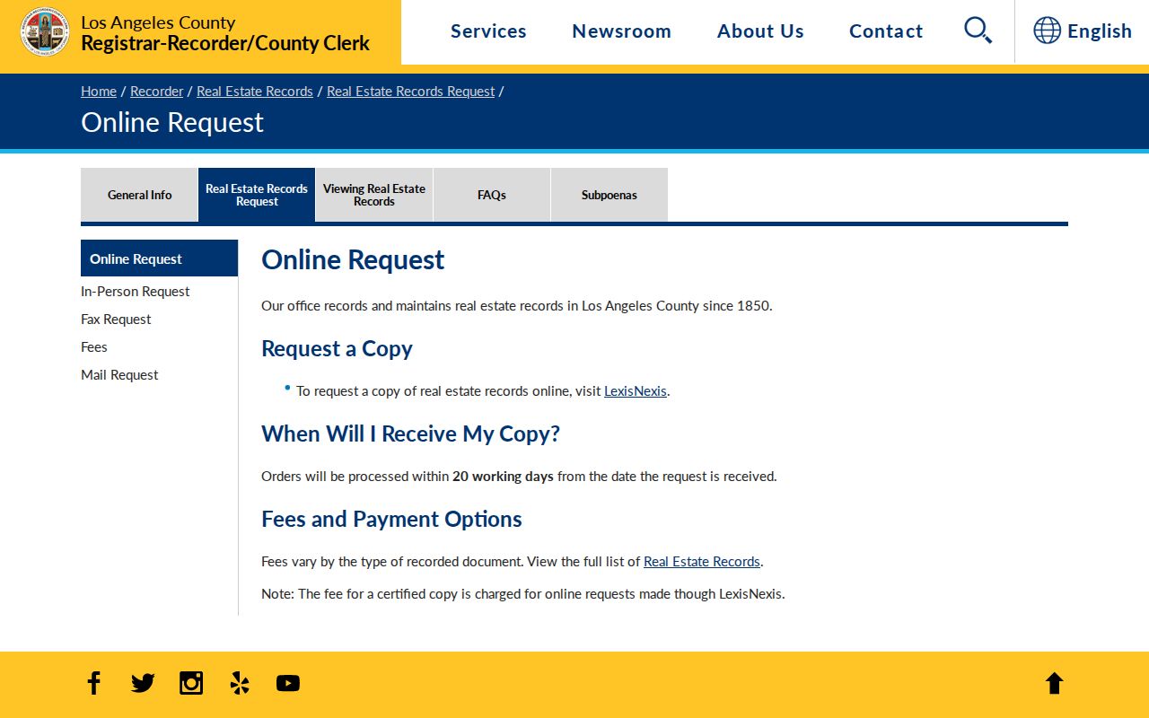
Once the known instrument number is in hand, a copy request is much more precise than asking the office to search a household.
Burbank Street Records From Permits
Building & Safety records can date additions, remodels, demolitions, inspections, final approvals, and certificates of occupancy. The public counter at 150 N. Third Street is open Monday-Thursday 8-3:30 and Friday 8-3, with noon-1 closed for lunch. A monthly issued or finaled report can point to a permit number, while the property portal can link an address or APN to records.
Permit parties have roles. An applicant may be an owner, architect, contractor, or representative. A certificate of occupancy describes a building approval, not the identity of everyone who used the space. Use the permit date to explain a change in the parcel's physical history, then use deeds, directories, newspapers, or probate to study people tied to the place.
If the online property system needs a login for a transaction, use its historical public-view path or ask the counter about paper and older records. For administrative material not exposed online, a focused CPRA request to the City Clerk may help. The city can locate an identifiable permit or report; it is not required to create a new analysis of every person associated with an address.
Read a Burbank Reverse Directory by Number
Reverse or criss-cross directories turn a street into a historical lookup. LAPL's Los Angeles reverse runs include 1906, 1927, and 1956-1987, while the broader digitized city and street-address collection spans 1875-1987. A reverse volume organizes entries by street and house number, then lists an occupant or telephone subscriber. Check the book's coverage map before treating a Burbank result as complete.
Search conventions are part of the evidence. LAPL notes that an address search may need a literal householder prefix such as h443 ... instead of 443 .... Numbered streets may appear as “Ave 64,” “Avenue Sixty-Four,” or in a different order, and abbreviations can shift between editions. If the text search fails, browse the scanned page by street and number.
For the county's explanation of address limits and name indexing, open the RR/CC real-estate records FAQ. The capture below reinforces why a reverse directory is a bridge to a name, not a substitute for the recorder.
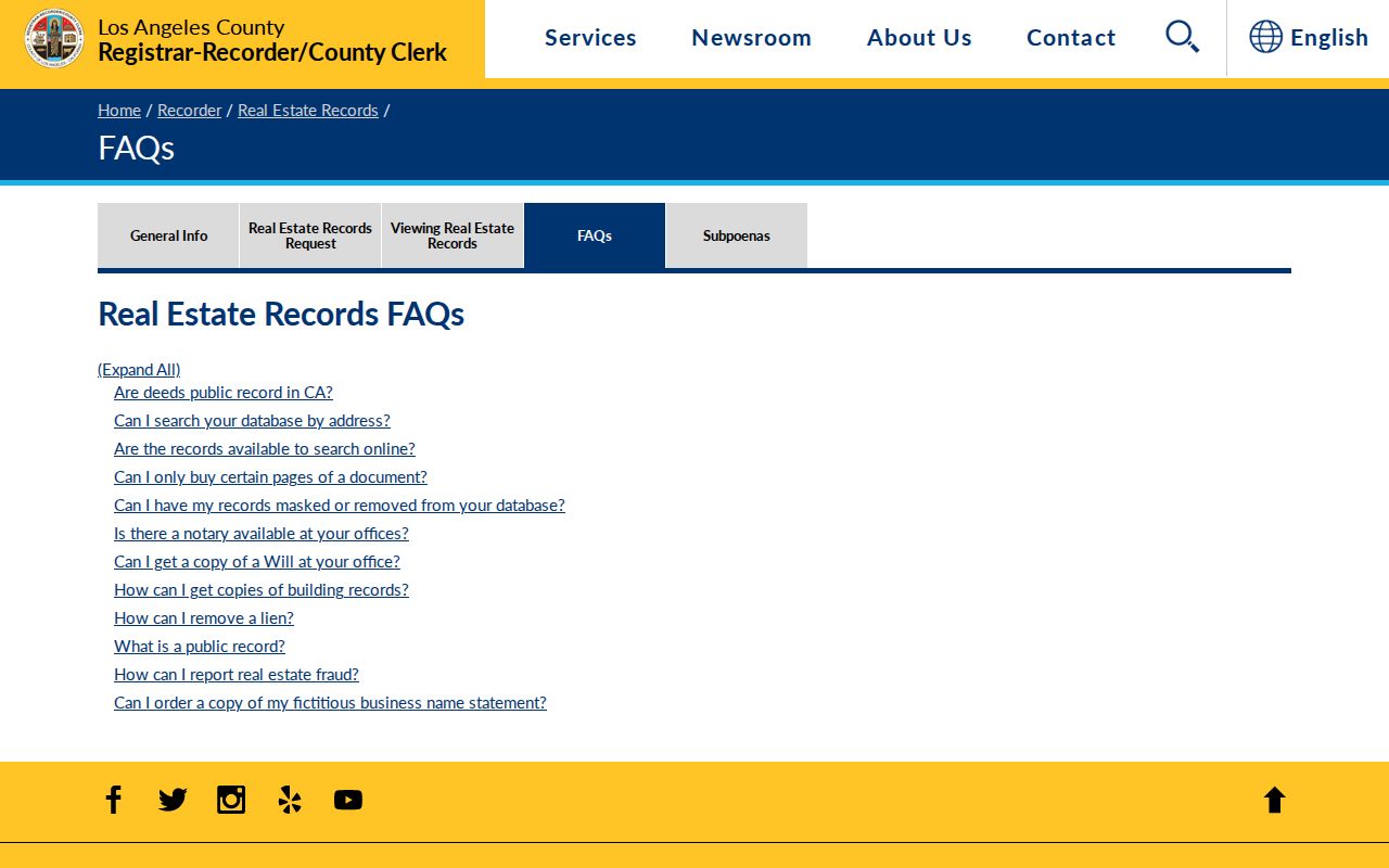
Pair the listed occupant with a city directory, newspaper notice, census household, or later deed. A directory lists the surveyed householder or subscriber, not every member of the household.
Burbank Street Names Need Historical Context
Burbank's street pattern includes east-west corridors such as Glenoaks, Olive, Magnolia, Burbank, and Vanowen, plus north-south and cross-valley routes such as San Fernando, Buena Vista, and Hollywood Way. Hillside streets and diagonal rail or freeway geometry interrupt a simple grid. Those names help a modern search, but a historical volume may use a number, direction, abbreviation, or older legal description.
Research did not verify one complete Burbank-only renumbering event or continuous address-change table. Do not invent a year when an old entry fails to match. Use Public Works address maps, tract and parcel maps, permit legal descriptions, Sanborn sheet indexes, and the parcel's AIN to bridge the gap. A street directory result is stronger when the map and legal parcel agree.
The county deed-index policy page shows the next step after an address is normalized. It explains why the street text is only the start of the recorded-owner trail.
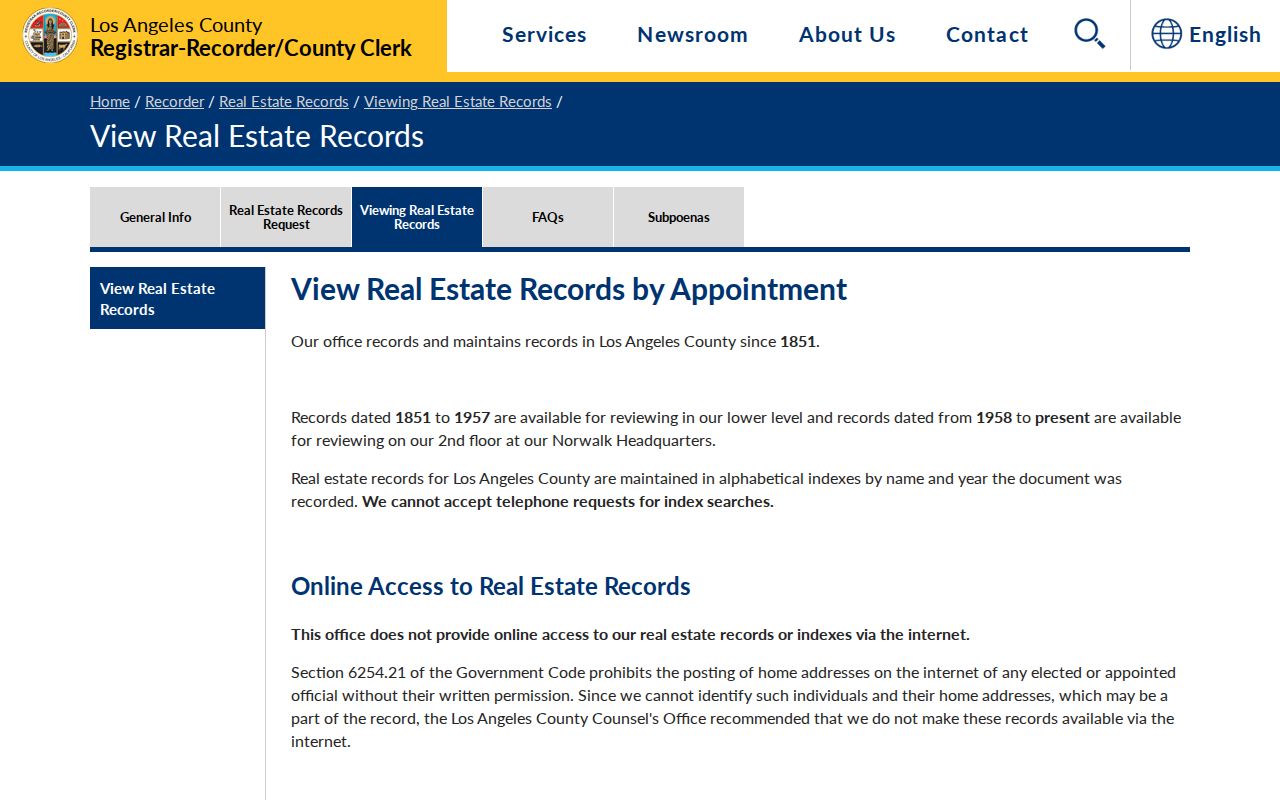
Keep the old street form, the modern street form, the AIN, and the legal description in your notes. That small record of variants makes a later search reproducible.
What a Burbank Street Directory Cannot Show
No public source gives a complete, current household list for a Burbank street. Non-owner occupants, children, guests, and people who decline directory listing may not appear. DMV address data is restricted by the federal Driver's Privacy Protection Act. Utility customer accounts, delivery records, and private association rosters are not public street rolls. The LA County voter status tool is intentionally a four-factor self-check, and approved voter-file access follows Elections Code §2194 rather than open web browsing.
Use the assessor for parcel evidence, the recorder for recorded transfers, the map for land context, the permit system for project history, and a library collection for historical listings. If the question is who lived at one address before, use the Burbank previous residents workflow. The answer may remain partial because official sources protect some people and serve different purposes.
Lawful use. Street and address records are appropriate for personal, lawful research, family history, property curiosity, and safe civic use. Do not use a Burbank street directory to stalk, harass, threaten, or intimidate anyone.